Geography
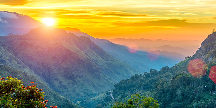
Mountain Scenery
Dramatic rock massifs, deep forested ravines, and morning mist characterize the landscape. The natural vantage points provide sweeping views across the southern plains.
A serene highland destination celebrated for mist-clad peaks, rich tea heritage, and biodiverse mountain terrain in Sri Lanka
Ella is a picturesque small town situated in the Badulla District of the Uva Province, approximately 200 kilometers east of Colombo in south-central Sri Lanka.
Perched at an approximate elevation of 1,041 meters (3,415 feet) above sea level, Ella occupies a strategic natural gap in the southern edge of the Central Highlands. This geological formation, widely known as the Ella Gap, creates a dramatic opening that looks out across the low-lying southern plains of Sri Lanka towards the Indian Ocean on clear days.
The region is characterized by steep cliff faces, cloud forests, undulating hills, and terraced Ceylon tea plantations. Historically a quiet agricultural settlement, Ella has developed into one of Sri Lanka’s most significant nature and eco-tourism hubs, attracting travelers interested in hiking, biological diversity, and cultural landscape appreciation.
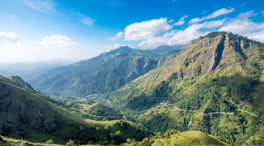
Ella combines spectacular mountain geography with living cultural traditions and peaceful outdoor recreation.
Dramatic rock massifs, deep forested ravines, and morning mist characterize the landscape. The natural vantage points provide sweeping views across the southern plains.
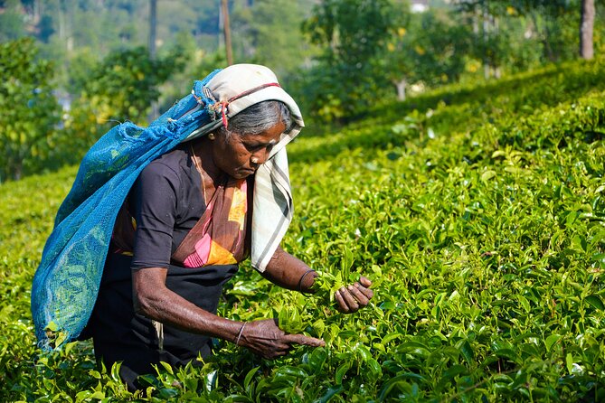
Surrounding hills are blanketed in century-old Ceylon tea estates. Visitors can observe traditional tea plucking and explore operational colonial-era tea processing factories.
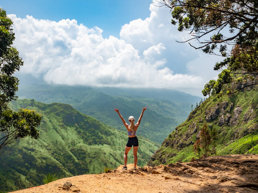
Ella serves as a central base for highland trekking. Routes range from the gentle climb up Little Adam's Peak to the more strenuous ascent of Ella Rock through eucalyptus forests.
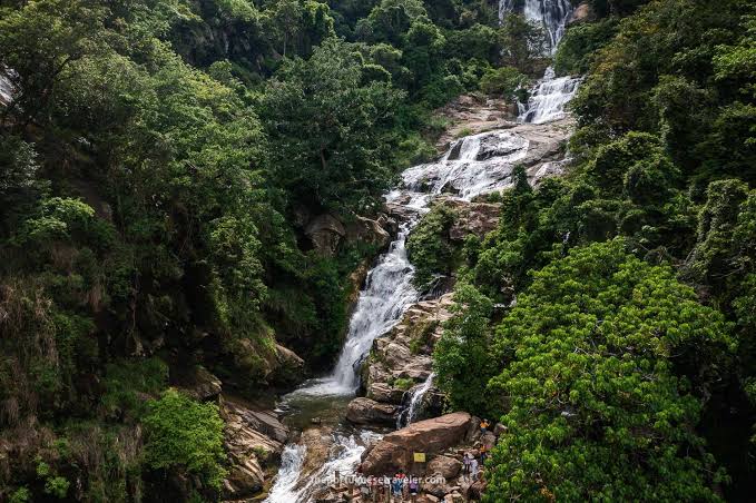
Fed by highland catchment systems, major cascades such as Ravana Falls flow near the town, surrounded by steep rocky gorges and endemic riverine vegetation.
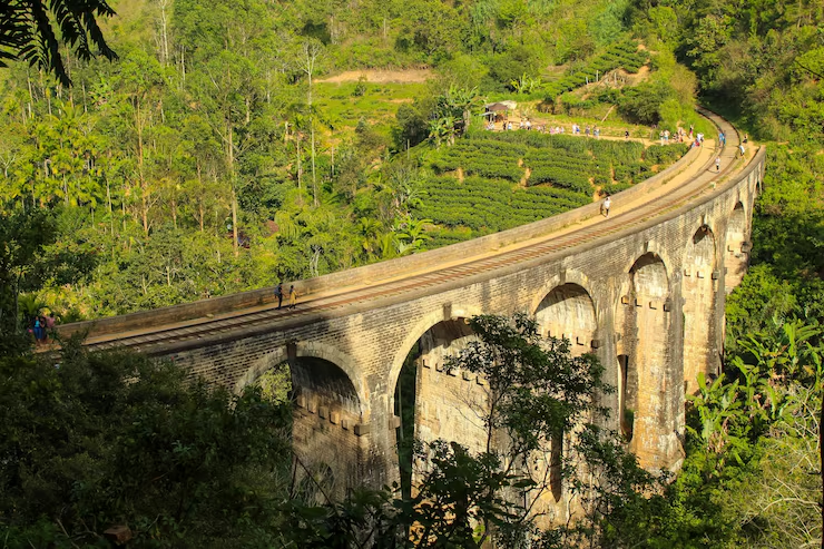
Home to the iconic 1921 Demodara Nine Arch Bridge and ancient folklore sites such as Ravana Cave, Ella blends architectural heritage with local Sri Lankan history.
A factual summary of geographic, administrative, and travel parameters for Ella.
| Information Category | Destination Details |
|---|---|
| Location | Central Highlands, South-Central Sri Lanka |
| District | Badulla District |
| Province | Uva Province |
| Approximate Elevation | 1,041 meters (3,415 feet) above sea level |
| Typical Temperature | 20°C to 26°C (68°F to 79°F) during daytime; cooler during evening hours |
| Main Natural Attractions | Ella Gap, Ella Rock, Little Adam's Peak (Punchi Sri Pada), Ravana Falls, Nil Diya Pokuna |
| Main Heritage Attractions | Demodara Nine Arch Bridge, Demodara Railway Loop, Ravana Cave, Dowa Rock Temple |
| Popular Tourism Activities | Hill country hiking, scenic train journeys, tea factory tours, viewpoint photography, local culinary tasting |
| Nearest Railway Hubs | Ella Railway Station, Demodara Station, Bandarawela Station |
Ella experiences a subtropical highland climate with moderate temperatures throughout the year, making it considerably cooler than the coastal lowlands of Sri Lanka.
This period generally experiences lower rainfall and clearer morning skies, providing favorable conditions for mountain trekking, scenic train photography, and outdoor exploration.
Rainfall increases during monsoon and inter-monsoon intervals, particularly between October and November. While rain showers are more frequent, the surrounding tea valleys become intensely green, and waterfalls flow with high volume. Trails may become slippery, and hikers are advised to exercise appropriate caution.
Note: Mountain weather in the central highlands can change rapidly. Early mornings generally provide the clearest vantage points before afternoon mist or clouds gather across the gap.
Ella is accessible via scenic railway lines, state and private road transport, and long-distance bus corridors.
The train journey connecting Kandy, Nanu Oya (Nuwara Eliya), and Ella is widely recognized as one of the most scenic rail corridors in Asia, winding through tea hills, bridges, and mountain tunnels directly to Ella Railway Station.
Visitors traveling by vehicle or taxi can access Ella via the A16 highway connecting through Bandarawela or via the scenic southern route through Wellawaya along the Ella-Wellawaya Road (A23).
Regular bus services operate between Ella and major transport hubs including Bandarawela, Badulla, Wellawaya, and Matara, offering budget-conscious access for domestic and international travelers.
Ella is located in Sri Lanka's Uva Province, surrounded by the scenic mountains and tea estates of the Central Highlands.
Ella, Badulla District, Uva Province, Sri Lanka. View larger map
Preserving the delicate ecology, cultural heritage, and community well-being of Ella depends on respectful visitor practices.
Carry a reusable water container and pack out all food wrappers and plastics from hiking trails and waterfall banks. Practice strict Leave-No-Trace principles.
Treat local residents, estate workers, and small business operators with courtesy and fairness. Support locally owned family eateries and certified guides.
Avoid creating unauthorized shortcuts on steep hillsides to prevent severe soil erosion and preserve delicate highland grass and plant ecosystems.
Refrain from picking wild orchids, disturbing wildlife, or polluting natural mountain water sources that downstream communities rely upon.
Dress modestly with shoulders and knees covered when visiting sacred shrines and rock temples. Ask for permission before taking photographs of individuals.